
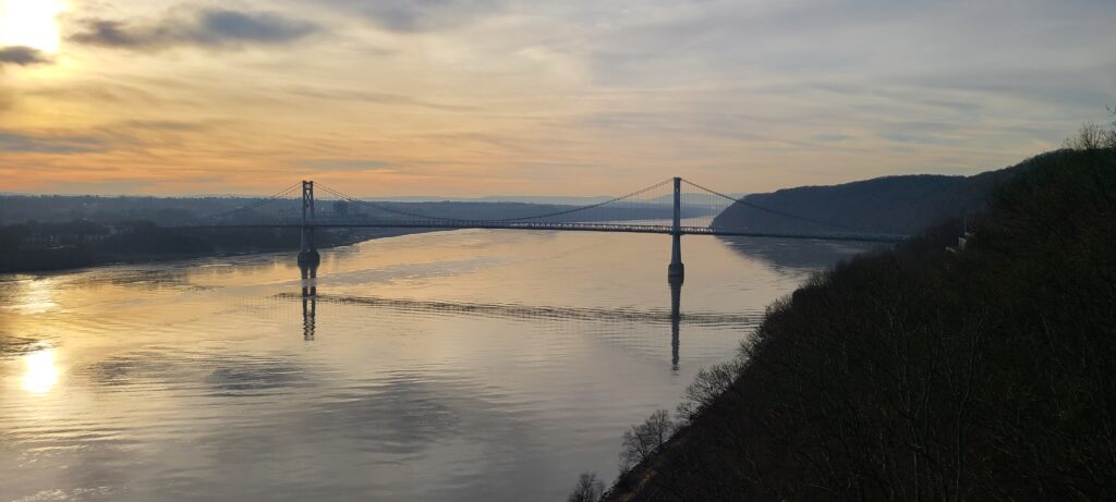
It was warm for a December morning, but it was still December and being high up on a bridge that spans a large river, who were we kidding – it was freezing!
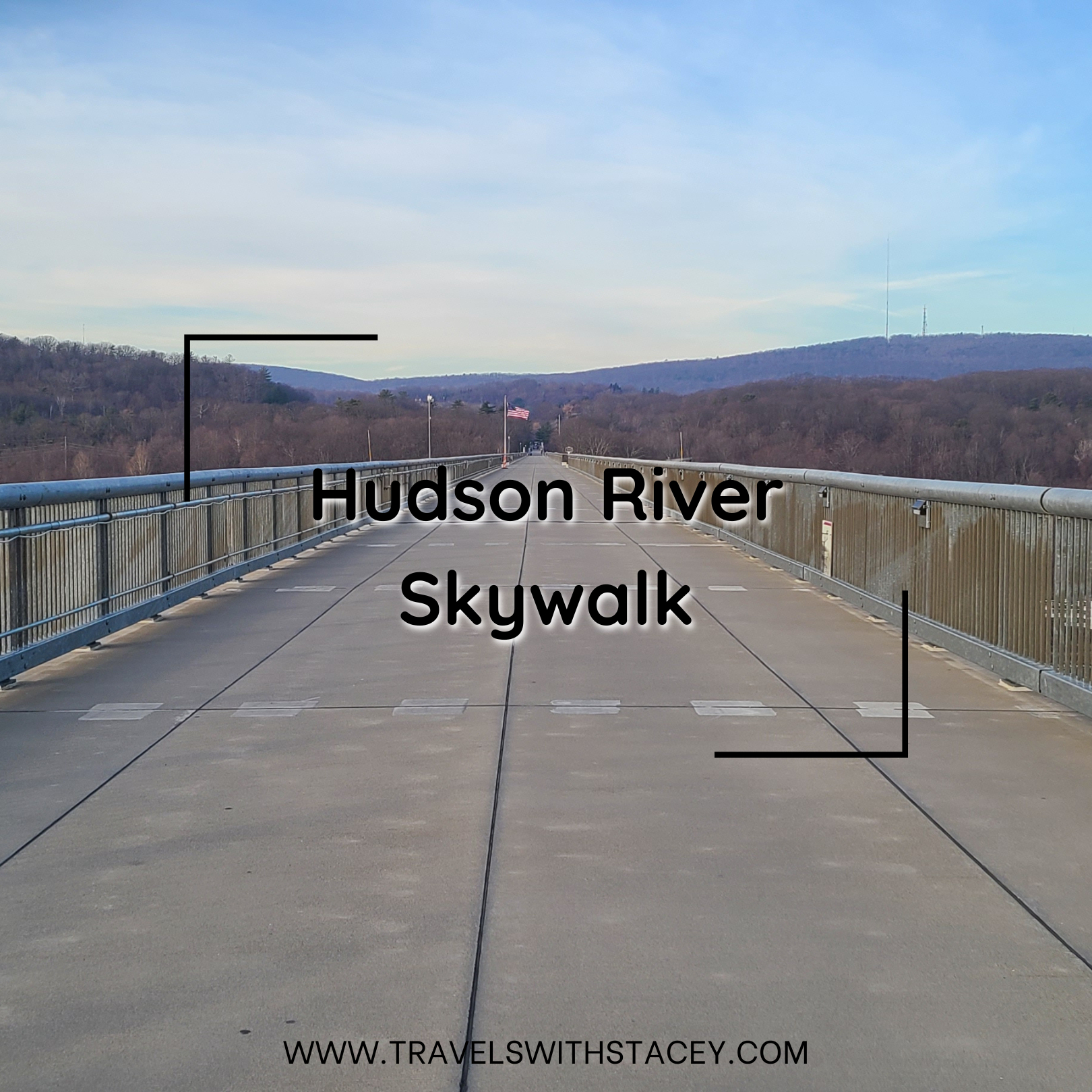
Walkway Over the Hudson State Historic Park was our first stop of the day after we had visited New York City on a spontaneous trip. I found this location mainly because of its alternative name – “Skywalk.” I had no idea what that meant, and then when I discovered what it was, it became a place for me to take my wife.
We found parking easy enough. At the time, it was free, but it looks like they are adding parking meters. We started the walk and found a fascinating statue honouring Sojourner Truth. We would admire it and put our gloves on. We were closer to the valley, and the bridge and the wind was starting to really bite.
We enjoyed the morning sun, our time together and the unique setting we were in. There were information plaques on the trailway, and we discovered that this location was plagued by fire. I cannot tell you how many places we have visited that have dealt with a fire or two, and I have become to think that fires were much more common than it is today with so many places experiencing some level of destruction.
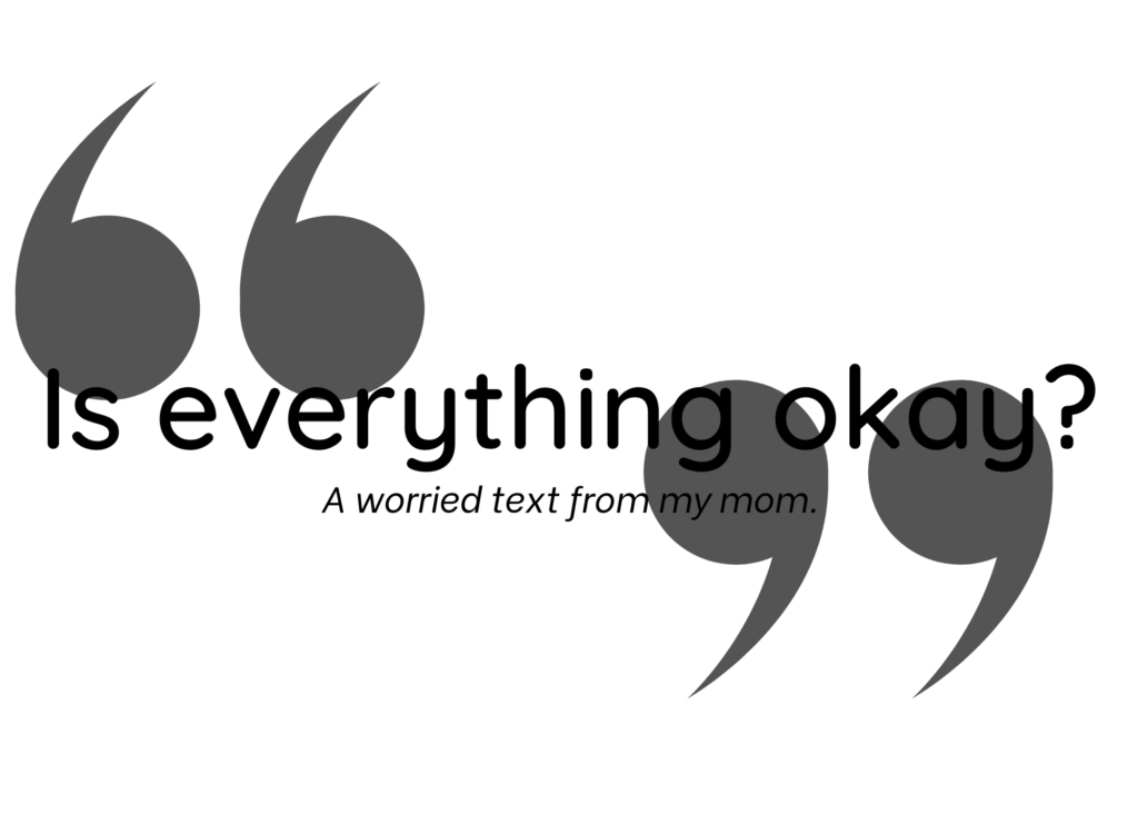
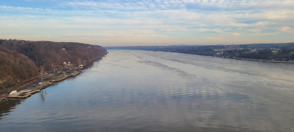
It was too cold to hold hands but not too cold to turn back. We were here, and we were enjoying the sun rising and watching a large riverboat slowly pushing its cargo. We stopped to admire the view. That is when I got the oddest text message from my mother asking if we were okay.
“Yeah,” I replied, confused.
I would learn later that my mother saw that we were in the middle of the Hudson River. Her confusion and near-panic were understandable. On her end, the bridge we were on was not clear, and she thought we had ditched the car somehow.
Whenever we travel, I use Google Maps for everything. I create custom maps of where I want to go and where I have been. I make maps for specific journeys, and when I am out and about with my wife exploring the world, I share my location with Mom.
Mom can only come with us on some journeys – sometimes there is no room in the car, especially if we are camping. So I share my journey through Google Maps. It is a live view of where and what we are doing. Mom can watch our little dot moving, and she knows we are driving. At times she wonders why we pass a destination that she sees on her end and then see where we stop and can look at the pictures we take. She was checking our progress on our return home when she must have gotten the fright of her life when our little blue dot was in the middle of the river.
We were okay, cold, but okay. Maybe a little freaked at how high this walkway was, but that was all part of the experience. We would only walk the length of the bridge but not all of it. This trail would go on for many more kilometres. We didn’t have the time to explore it all, but we did get to see the main feature.
We would return to our car, passing the Sojourner Truth statue again and reflecting on this area’s history. Now, it is a peaceful walk over a river. Then, many people trying to escape slavery to find a better life. Times do change, and history will outlive us all. I am grateful that we live in a more peaceful society that is trying to make amends and improve the lives of others.
- This location can be found on my Featured Map. Marked on this map are all the locations that I have visited that are worth further exploration.
- This is an old rail line. It is very high but sturdy, with barriers that allow walkers to get close and look over.
- It can be windy.
- Free access with the exception of paid parking (coming soon).

1 COMMENT