
Custom Google Maps
Custom Google Maps. Decades ago, my father took us on a road trip to Florida. As a child, I never understood just how difficult it was to plan such a journey before the existence of the internet. Much of where he took us was by word of mouth or through a travel agent or just stumbling upon it in his travels. Today, we have a potent and free tool called Google. Without Google, I doubt I would find a tenth of my destinations independently.
The most useful Google feature is Google Maps. Not only can I search for destinations using Maps, but I can create my own custom map. I create individual maps for when I am going on a road trip; this makes it easier to find the next stop on our trek. I have themed maps like murals where if I am in an area I can easily load up these maps and visit these locations.
Below are the maps that I have created. Feel free to use these on your travels.
These are the maps that I have made and refer to the most. I created these to help in my planning of upcoming trips. I call them my Go-To Maps.
- North American Reciprocal Museums. This is a combined map of NARM and ROAM when I purchased a membership to Detroit Institute of Art. The membership provides free access to many museums in the USA and Canada.
- Reciprocal Admissions Program. When I purchased a membership to the Royal Botanical Garden, it included free access to many botanical sites.
- Provincial and State Campgrounds. A map showing most of the government run campgrounds. Often times, these sites provide more privacy than privately run locations. Provincial and State parks are my first option when planning an overnight trip.
Featured Map. These are all the places that have been featured on this website. Click on an icon to see the link to a page describing our journey. It also includes many of the other places we have been. We have been to so many that it is very hard to post something about everywhere.
I have been compiling maps of the states and provinces. It is easier to research a trip with these smaller maps than to have thousands of potential places to visit on one gigantic map. These maps are always being updated, so be sure to check them regularly.
- National Parks of Canada and the USA
- Places We Want To See – ALABAMA
- Places We Want To See – ALASKA
- Places We Want To See – ALBERTA
- Places We Want To See – ARKANSAS
- Places We Want To See – BRITISH COLUMBIA
- Places We Want To See – CALIFORNIA
- Places We Want To See – COLORADO
- Places We Want To See – CONNECTICUT
- Places We Want To See – DELAWARE
- Places We Want To See – FLORIDA
- Places We Want To See – GEORGIA
- Places We Want To See – IDAHO
- Places We Want To See – ILLINOIS
- Places We Want To See – INDIANA
- Places We Want To See – IOWA
- Places We Want To See – KANSAS
- Places We Want To See – KENTUCKY
- Places We Want To See – LOUISIANA
- Places We Want To See – MAINE
- Places We Want To See – MANITOBA
- Places We Want To See – MARYLAND
- Places We Want To See – MASSACHUSETTS
- Places We Want To See – MICHIGAN
- Places We Want To See – MISSOURI
- Places We Want To See – MONTANA
- Places We Want To See – NEBRASKA
- Places We Want To See – NEVADA
- Places We Want To See – NEW BRUNSWICK
- Places We Want To See – NEWFOUNDLAND
- Places We Want To See – NEW HAMPSHIRE
- Places We Want To See – NEW JERSEY
- Places We Want To See – NEW MEXICO
- Places We Want To See – NEW YORK
- Places We Want To See – NORTH CAROLINA
- Places We Want To See – NORTH DAKOTA
- Places We Want To See – NORTHWEST TERRITORIES
- Places We Want To See – NOVA SCOTIA
- Places We Want To See – NUNAVUT
- Places We Want To See – OHIO
- Places We Want To See – OKLAHOMA
- Places We Want To See – ONTARIO
- Places We Want To See – OREGON
- Places We Want To See – PENNSYLVANIA
- Places We Want To See – PRINCE EDWARD ISLAND
- Places We Want To See – QUEBEC
- Places We Want To See – RHODE ISLAND
- Places We Want To See – SASKATCHEWAN
- Places We Want To See – SOUTH CAROLINA
- Places We Want To See – SOUTH DAKOTA
- Places We Want To See – TENNESSEE
- Places We Want To See – TEXAS
- Places We Want To See – UTAH
- Places We Want To See – VERMONT
- Places We Want To See – VIRGINIA
- Places We Want To See – WASHINGTON
- Places We Want To See – WEST VIRGINIA
- Places We Want To See – WISCONSIN
- Places We Want To See – WYOMING
- Places We Want To See – YUKON
- Places We Want To See – UK

Christmas Google Map
Christmas Map 2020. This was my very first map that reached a great level of popularity. It is now out of date but I plan on creating a new one soon.
Christmas Stores, Events and Destinations. The newest map is meant to be useable for the next few Christmases. Be sure to keep checking it out, as I will update it whenever I learn of new Christmas places to visit.
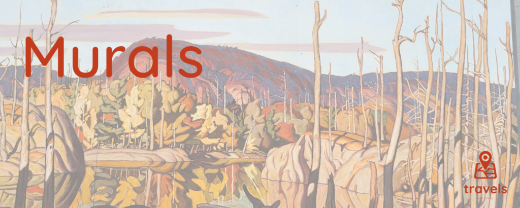
Google Maps of Murals
One of the fastest ways of making our towns and cities beautiful is to add painted images. These may be called murals, or graffiti art, street art or (my favourite term) Art Therapy. Locations are approximate. Murals can last decades in some areas or be there for a season. This list is far from complete and often times when we are out viewing these, we discover so many more that is not featured on this map. These maps are constantly being updated.
- Ontario and Quebec Murals
- New York State Murals
- Pennsylvania and West Virginia Murals
- Winnipeg Murals
- Cincinnati Art Map
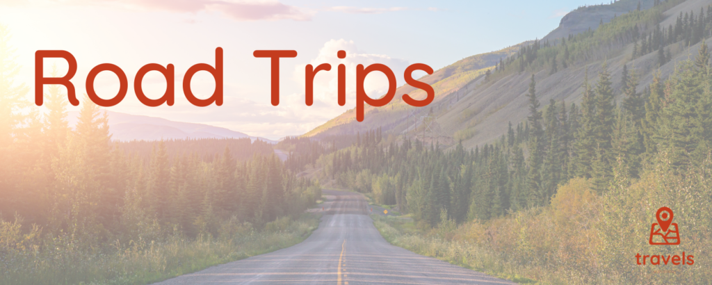
Road Trip Google Maps
These are various maps and itineraries I made for myself and others. Feel free to use them for your own personal trips.
Trips We Took in 2021:
- Quebec – This map I made as we explored the province of Quebec over one week. The itinerary for this trip needs to be reconstructed. July 31 to August 6.
Trips We Took in 2022:
- Travelling Through the Mountains to West Virginia – Our first major two-week trip into West Virginia. June 24 to July 8.
- Frankenmuth Christmas – This Michigan town almost feels like the capital of Christmas. December 16 to December 18.
Trips We Took in 2023:
- Family Day Weekend Road Trip to Ottawa is a long weekend trip with my wife and mother. February 16 to February 19.
- Three-day weekend trip to Cleveland – A simple, quick visit to a city with so much to offer. This trip is an excellent appetizer for future visits to this famous Ohio city. August 25 to August 27.
- Seneca Falls – A three-day weekend trip to the centre of the women’s movement in the USA. September 1 to September 4.
- Friday the 13th: I created a map for a Halloween visit to Sleepy Hollow. Since there are several waterfall sites to visit, this map can easily be converted to a spring or fall visit. October 12 to October 15.
- Washington, D.C. – A four-day trip to the capital during Christmas Break. December 26 to December 30.
Trips We Took in 2024:
- Let’s Play Hooky, Cleveland Style – A long weekend trip to this city. February 22 to February 25.
- Virginia Beach – We would spend a week here during March Break. March 8 to March 16.
- Easter at Fort Wayne – I took my wife to this Indiana city for art, murals, cars and museums. March 28 to March 31.
- Overnight in Detroit – A weekend trip to see Greenfield Village on its opening weekend. April 12 to April 14.
- Tip Toe Through the Tulips – A trip to see the Tulip Festival in Holland, Michigan. April 25 to April 28.
- Celebrating the Queen’s Birthday in a Foreign Country – The first long summer weekend is spent in Akron and Mansfield, Ohio. May 17 to May 20.
- Marching Our Way To Bedford – A three-day weekend trip that included a Civil War re-enactment. June 6 to June 9.
- Summer Coastal Drive – A three-week summer holiday in the Canadian Maritimes and a few days in the USA. July 5 to July 25.
- Mozart’s Funeral in Montreal – Off to see the Requiem performed in the beautiful Notre Dame. November 1 to November 3.
- Let’s Ride A Bike To The Moon—Dayton, Ohio, following the flight progression from the Wright brothers to Neil Armstrong. November 21 to November 24.
- Blown Away by Christmas in the Windy City – A Christmas vacation for a few days in Chicago. December 26 to December 31
Trips We Took in 2025:
- Blown Away By The Mob in the Windy City – An encore trip to Chicago focusing on crime. February 13 to February 17.
- Trying Not To Freeze To Death While Camping—Our March Break trip took place mainly in Tennessee. March 7 to March 15.
- Falling Head Over Heels For Waterfalls – A hike that will have us visit nearly 20 waterfalls. May 16 to May 19.
- Taking Mom To Her First Camping Trip in Algonquin on the First Day of Summer – A simple weekend camping trip before our big summer vacation. June 20 to June 22
- America the Beautiful – A three-week trip where we spend much of our time exploring American National Parks. June 27 to July 18.
- Third Time’s The Charm – Four-day weekend trip to Cincinnati. August 28 to September 1.
- Bewitched in Salem, MA – Visiting the site of the witch trials during Halloween! October 29 to November 2.
- Philadelphia – The City of Christmasly Love – An extended Christmas vacation in this historic city. December 26 to January 2.
Trips We Took in 2026:
- Taking My Wife Out of Walmart and Taking Her to Another Walmart – A weekend trip to see the world’s largest Walmart. January 30 to February 1.
- Mom, Sis and Me – This is the first time we have included my sister on a road trip! March 6 to 8.
- Atlanta March Break 2026 – The best part about being a school bus driver is the time off! March 13 to March 21.
- A Floral Mother’s Day – Flowers and more flowers to celebrate my Mom. May 9.
- Visiting a Country that Fought Against the Monarchy, but in the End Adored Queen Victoria – Victoria Weekend to see destinations mainly in and around Pittsburgh. May 15 to 18.
- The Four of Us Falling For The Falls – A single-day and a weekend trip to Niagara Falls. On May 30, we will do the single-day trip and save the weekend trip for a later time.
Travel Itineraries For Future Trips:
- Terrorizing the Grandkids—We could take the grandchildren to Parc Omega on a future trip. I hope to get some good laughs in Mwah ha ha ha ha!
- Grateful and Thankful for an Extra Long Thanksgiving – A four-day weekend trip to see the sights and sounds in Cincinnati, Ohio.
- Fun Frozen Falls Day Trip – a single-day trip to Buffalo and Niagara to be taken after a lengthy cold spell in the winter.
- Walking Among the Mighty Trees of BC – A three-week summer vacation to Vancouver Island.
- Visiting the Province That Gave Us Poutine – A five-day adventure to celebrate Quebec and its fabulous invention – the poutine!
- Escaping the Jazz and Blues Festival – Each year, our town has jazz and blues, and we always leave. This year, things made us stay. At least there is this trip for next year.
- Chasing the Easter Bunny in Cincinnati – My second planned trip to Cincinnati, but it was cancelled at the last minute.
- I Am Not Feeling Well. I Need Some Vitamin CCC – a week-long trip to Cincinnati and the area.
- A Diamond In The Rough – a weekend trip where we hope to get rich!
- Caitlyn’s Birthmas – A trip I had planned but didn’t work out due to other obligations.
- You Are Not Invited – I modified Caitlyn’s Birthmas to only include the wife and me since Cait would not be able to come.
- Niagara Christmas 2025 – A one-day trip to the Niagara area of Canada and the USA. This trip is transferable to any year since these are annual events we will be seeing.
- Emagine Charlene’s Birthday – One of two options for a way to celebrate my wife’s birthday.
Travel Itineraries Made For Others:
- Acadia Day – Visiting the Canadian section of Acadia to celebrate Acadia Day on August 15th.
- My Parents Leave to See the Leaves – Another fall colours trip, this time in central Ontario.
- A Girls’ Weekend in Quebec City – A must-do travel plan for a first visit to Quebec City.
- A Girls’ Weekend in Niagara and Buffalo – A custom-made shopping trip to this area that includes some of the sights.
- Autumn Trip to Northern Ontario – Enjoy the changing leaves in this week-long exploration.
- Where the Money I$ – A custom-made trip to Ottawa to see where money is made.
- Cambridge – A map of mostly the downtown core of Cambridge, Ontario. It includes murals, historic and heritage sites, and filming locations of Handmaid’s Tale.
- Visiting the Province That Gave Us Poutine—Marc and Carrie Version: A week-long trip to Gaspe and back.
- Go East – A different style of itinerary and map from my usual—an east coast trip to Quebec, New Brunswick and PEI.
- I Love New York Autumn Colours Tour – a four-day travel plan for western New York.
- Halloween Southern Ontario – a three-day fright-filled trip.